UPDATE: ARCHES NATIONAL PARK HAS A TIMED ENTRY SYSTEM. VISIT RECREATION.GOV TO OBTAIN YOUR TICKET.

Recommended Trails

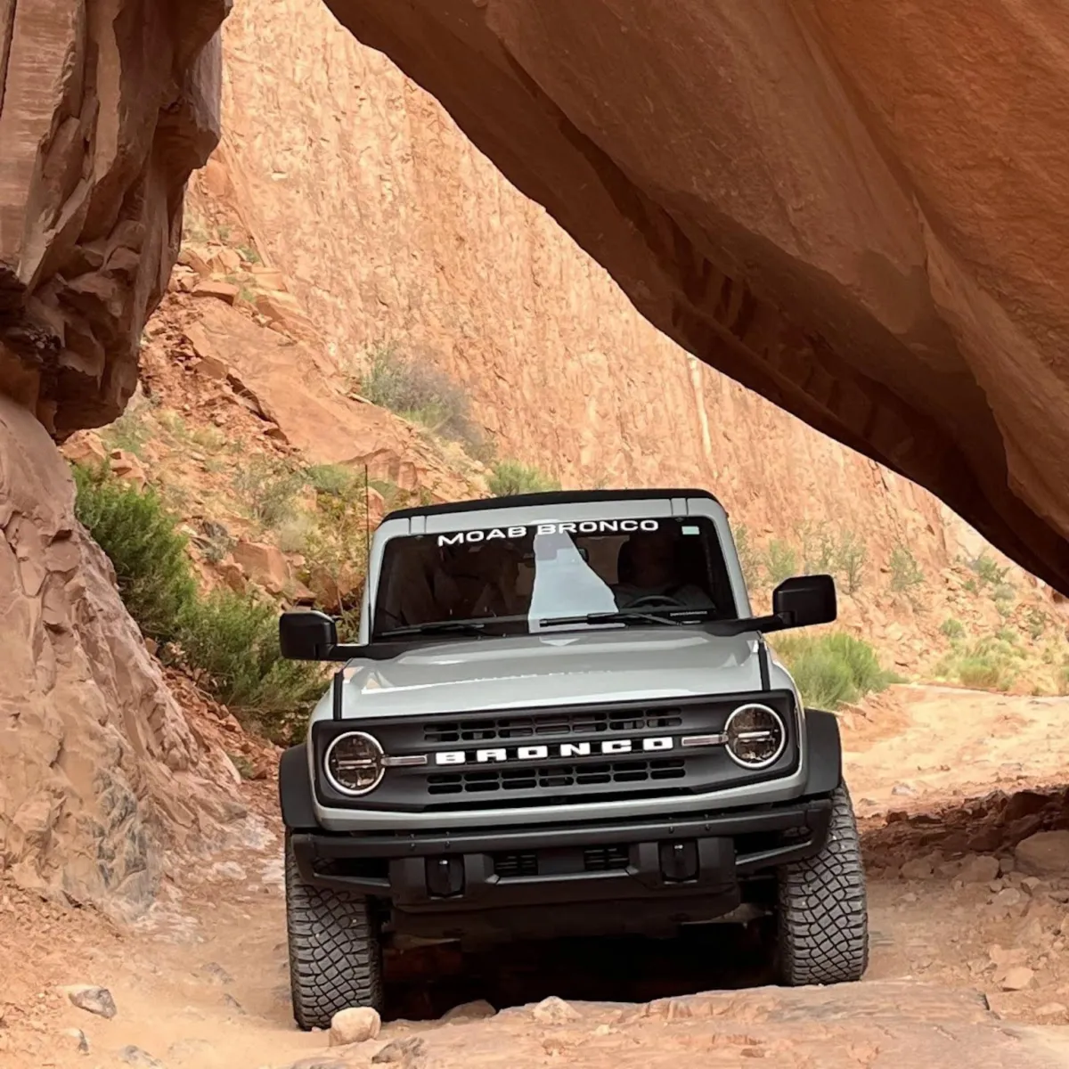
Experience adventure in Moab with a New Ford Bronco!
LONG CANYON PUCKER PASS


Location: Southwest of Moab between highways 313 and 279 (along the river). North of Canyonlands National Park and Dead Horse Point State Park. This trail is described downhill, assuming you are starting from Canyonlands National Park or Dead Horse State Park.
Rating: Easy. A wide gravel road except through Pucker Pass where it is narrow and steep. Route; found easy.
Attractions: Amazing scenic views (from top to bottom). Petroglyph panels on highway 279
Time & Distance: 7.5 miles from highway 313 to highway 279. Allow 1 hour.
Trail Description: From downtown Moab travel North on highway 191 to highway 313 about 11 miles. (left at Moab Giants dinosaur museum). Reset your odometer once on highway 313. Travel 14.5 miles on highway 313 following signs to Canyonlands National Park. Turn left at Dead Horse Point State Park. Travel 1.6 miles to a wide gravel dirt road on the left. Follow a wide gravel road east, ignoring all side roads. After about 3 miles the road curves left and starts downhill. At 3.3 miles, after a tight switchback, the road narrows significantly as you drop steeply through Pucker Pass. This section is usually quite easy when dry but can be impassable in heavy rainstorms. You will pass under a giant fallen rock at 3.5 miles. After this point, the road widens and is very easy all the way to highway 279 at 7.5 miles. Don’t let the fantastic views distract the driver. As you near highway 279, look for Jug Handle Arch on the left.
Return: A left turn on highway 279 takes you back to highway 191. Right turn onto highway 191 will take you back to downtown Moab.
GEMINI BRIDGES
Location: North of downtown Moab on highway 191 about 10 miles. Look for the Gemini Bridges sign on the highway. Turn left into the parking area. This turn is 1.3 miles before highway 313.
Rating: Easy to Moderate. The trail begins on a high, two-lane shelf road. Although easy, use extra caution when wet. Parts of the trail are rocky or sandy but suitable for a stock, high-clearance vehicle with skid plates.
Attractions: This is one of the most popular trails in Moab. The east side has dramatic views of the La Sal Mountains and Arches National Park. The Gemini Bridges are really two large arches, side by side and several hundred feet high. The bridges are not apparent until you get close. The area is fenced off the last 100 yards so you can park and walk. Very dramatic! Don’t let children play in this area by themselves.
Time & Distance: It is 7.7 miles to Gemini Bridges from the east side (near Highway 191) or 5.6 miles from the west side (starting at Highway 313), a total of 13.3 miles. Allow about 3 hours for the whole trip, plus your return time.
Trail Description: Reset your odometer when you turn off highway 191. Pass through the parking area, cross a set of railroad tracks and go left following a wide dirt road which parallels highway 191. The road will turn west and start to climb. At the high point along this ledge road, don’t be distracted. Pay close attention to traffic which can be heavy at certain times of the year. This road accesses many trails in the area and is extremely popular. Continue south as the road descends and swings a little right through a wide valley. After passing Gooney Bird Rock, other roads head in various directions, but the main road is well traveled. At 4.7 miles, turn right at a T and climb a steep hill. Turn right at 5.1 miles and again at 5.3 miles a sign indicates Bull Canyon Trail to the left. Bull Canyon takes you down to the bottom of the bridges. Make an important left turn at 6.1 miles. Soon you begin crossing slickrock marked with painted dashed lines. At 7.0 stay right as a lesser road goes left. At 7.3 bear left (05). A larger road comes in from the right at 7.5. You will exit on this road later. It is required that you park where the fenced area is and walk about 100 yards to the Gemini Bridges. Be very careful exploring on and around the bridges. It is a long way down!
Return: You may return the way you came or head back to town with a right turn on the paved highway 313. Our favorite way is to turn left and drive about 9 miles to Canyonlands National Park. After exploring the park, drive down the Shafer Switchbacks and Shafer trail to the Potash road and follow the paved scenic byway 279 for about 17 miles and reconnect with highway 191. On the scenic byway 279 keep your eyes open for wildlife, dinosaur tracks, Indian writings and a lot of rock climbers.
SHAFER TRAIL
Location: Drive North of Moab on Highway 191 about 11 miles, turn left on highway 313 to Dead Horse Point State Park and Canyonlands National Park. The trail starts off to the left just after entering the Island in the Sky district of Canyonlands National Park. There is a sign at the starting point. The park will require a fee or your national park pass to enter.
Rating: Easy. A well maintained road suitable for stock high-clearance four-wheel drive vehicles. It is possible that it will be muddy or icy during wet times of the year and the switchbacks can experience closure at the National Park’s discretion. A brief, narrow shelf road crosses high above the Colorado River. Route finding is easy. Summers are hot and dry so carry at least one gallon of drinking water per person.
Attractions: This trail descends 1,500 feet on a section of switchbacks in just over a mile. Wildlife such as Bighorn Sheep can be seen depending on the time of the year. This trail has incredible views of the Colorado River and the La Sal Mountains.
Time & Distance: From the trailhead to the pavement on byway 279 is 18.2 miles. Allow approximately 2.5 hours on the trail and an additional 30 to 45 minutes on byway 279 back to highway 191.
Trail Description: Reset your odometer where the trail starts. Start in the g.o.a.t mode “Rock Crawl” to engage 4 wheel low and set a lower gear this will help you from riding your brakes down the steep switchbacks. When you encounter another vehicle coming towards you, whoever gets to the widest spot first waits for the other driver to pass. At 4.3 miles you will go through a gate and come to an intersection that goes straight or makes a left turn. Left returns to Moab. If time allows, stay straight on the White Rim Trail and visit Musselman Arch, approximately 30 to 45 minutes each way. At 6.1 miles you will come across the last restroom facility until Moab. Cross the national park boundary and continue down Shafer Canyon onto a dramatic shelf road that sets above the Gooseneck of the Colorado River. At 9.1 miles you can see an awning on the left rim. That is Dead Horse Point State Park. Directly south of the awning is Fossil Point. This is where the car jumped off the cliff in the final scene of Thelma and Louise. The main road will go left and pass through a fence. Stay on the main road. At 12.6 miles you will see a glimpse of the Potash plant evaporation ponds. Continue straight as a lesser road goes right to an overlook east of Pyramid Butte. Follow a chain link fence around the large blue evaporation ponds of the potash plant. Then bear right. (to your left is a private road). Watch for vehicles crossing from the plant. Continue straight at the stop sign. The road will gradually descend to the river. At 18.9 miles you will pass the Potash boat ramp and be back on the paved road. You can take your vehicle out of 4 wheel drive at this point.
Return: Once you are on the pavement Scenic Byway 279 you will travel approximately 17 miles before intersecting with Highway 191. This road is scenic and well marked with Indian petroglyphs, hiking trails, arches, and rock climbers. A right turn at the intersection will take you back to Moab.
HURRAH PASS
Location: Southwest of Moab, west of Kane Creek Road. Go south on Main Street in Moab and turn right at the McDonald’s Restaurant on Kane Creek Rd. Keep left at the first stop sign and headed south along the Colorado River. The pavement ends at 4.7 miles and the road will swing left away from the river.
Rating: Easy. A wide gravel road most of the way. Closer to the pass, it narrows somewhat and becomes rockier with mild, tippy spots. Several water crossings on Kane Creek Road are usually shallow, but they can be very deep and unsafe to cross in the spring or after heavy rain.
Attractions: This drive has some spectacular scenery. Plan to stop to see ancient petroglyphs on a large boulder next to the road at Birthing Rock.
Time & Distance: Hurrah Pass is 9.7 miles from the end of the pavement. Allow 2 or 3 hours for the round trip.
Trail Description: Reset your odometer where the pavement ends. Continue on a wide gravel road. At 1.3 miles look for Indian writings on a large boulder that is Birthing Rock. Keep right after crossing Kane Creek at 6.3 miles. At mile 6.6 Kane Creek Canyon Trail goes left. Kane Creek Canyon is on our prohibited list so be sure to swing right. You will begin a gradual climb. At 8.9 miles a lesser road on the right goes to a small overlook. The pass is reached at 9.7 miles. Beyond the pass starts a more difficult descent to Chicken Corners and Lockhart Basin Trails.
Return: Make it an all-day ride by continuing on to Chicken Corners or just turn around and go back the way you came
ONION CREEK AND FISHER TOWERS
Location: Northeast of Moab. From highway 191 travel north of Moab, at the Colorado River Bridge turn right at the light onto highway scenic byway 128 along the Colorado River. Drive 20.2 miles on highway 128 until you see the sign for Onion Creek along the highway. To go to Fisher Towers, stay on highway 128 another 0.8 miles and turn right after the Fisher Towers sign.
Rating: Easy. Onion Creek Road is a well maintained road, but can get washed out along its creek crossings. The creek is usually shallow and only a few inches deep, but can be deeper following heavy rains. The upper section can be slippery and dangerous when wet and will require 4 wheel drive. The road to Fisher Towers is suitable for passenger cars.
Attractions: Onion Creek Road is a relaxing drive through a beautiful deep-cut canyon. The red rock is in the Cutler formation. This area has very distinctive formations. Fisher Towers is a popular tourist destination with spectacular red rock towers. Part of the last Austin Powers movie was filmed in this area, as well as the City Slicker movies and many commercials.
Time & Distance: Onion Creek Road as described here is about 10 miles one way. Fisher Towers is about 2 miles one way. Allow 2 hours round-trip driving time for Onion Creek and approximately an additional 30 minutes for Fisher Towers. With stops and hikes you can easily spend a full day in the area.
Trail Description: Reset your odometer as you turn right off Hwy 128 onto Onion Creek Road. You’ll pass a parking area before the first creek crossing within the first mile. Many more creek crossings follow. This is open range so watch for cattle on the road. Cross a small bridge at 3.6 miles. Prior to having the bridge, the road actually followed the narrow creek under the bridge! Your nose will tell you when you pass by Stinking Spring, a sulphur-based natural spring. Soon a sign indicates you are leaving the Colorado River Recreation Area. You’ll begin to climb out of the canyon on a winding road. Be careful here if the road is wet. Continue as far as you are comfortable going as this road turns into Fisher Valley Road. Make sure you leave all gates as you find them, since this is cattle country. At 9.5 miles is the end of the trail. Left goes to Rose Garden Hill Trail and is rated difficult and is on the list of prohibited trails .
Return: Turn around at mile 9.5 and come back the same way you came.
CHICKEN CORNERS
Location: Southwest of Moab and Kane Creek Road. South of Dead Horse Point State Park and the Colorado River. Follow trail description for Hurrah Pass to reach the start of this trail.
Rating: Moderate. Just a few rough spots on this predominantly easy trail. At one point, you’re forced near the edge of a high cliff above the Colorado River. This spot is intimidating, but easy. Suitable for stock, high-clearance vehicles under normal conditions. Water crossings along Kane Creek can be deep in early spring or after heavy rains. It's hot in summer so bring plenty of water.
Attractions: Descend from Hurrah Pass on the more remote west side to the scenic Colorado River gorge. See Dead Horse State Park and Pyramid Butte across the river. Please stay on the trail at all times. There is a lot of off-trail damage in this area and continued abuse could result in the area being closed.
Time & Distance: It’s 11.5 from the top of Hurrah Pass to the end of the trail. Allow about 4 hours for the round trip plus an additional hour to reach Hurrah Pass.
Trail Description: Reset your odometer at Hurrah Pass. Start down the west side on a rocky, winding ledge road. At 2.5 miles keep left uphill. Jackson Hole Trail goes right. Trail conditions worsen as you drop into a dry wash. A rocky challenge at 2.8, then keep sharply right uphill. The road flattens out as you head southwest. This is open range so watch for cattle on the road. Keep right following a sign to Lockhart Basin. The road gets rocky again and narrows to a single lane as it winds closer to the river in places. You’ll pass through a barbed wire gate (close it after going through) before reaching a key fork at 6.8 miles. A sign should indicate Lockhart Basin left. Sometimes the sign is knocked down or removed by vandals. Keep right, climbing out of a dry, rocky wash. From here the trail is well defined as it crosses a broad, flat area CHICKEN CORNERS with several easy rocky sections. Gradually a high wall on the left forces you closer to a cliff edge overlooking the river. The narrowest point at 10.0 miles is the drivable Chicken Corner. It is easy, but may be intimidating to some. The road continues another 1.5 miles where it comes to an abrupt end at a remote overlook. Dead Horse Point Overlook is directly north across the river.
Return: Return the way you came.
DOME PLATEAU
Location: From Moab head North to HWY 128 at the Colorado River. Drive for approximately east 30 miles along the Colorado River. Just across the Colorado River turn left on a gravel road at mile marker 30. Note the first part of the trail crosses private property - please be respectful. Follow the road west and then south to a spectacular overlook. The return loop routes you to the north past La Boca Arch and east past some old mining structures before returning to Highway 128 for the drive back into town.
Rating: Moderate. When dry, most of the trail is easy except for a few steep, rocky sections. The road is sometimes impassable in early spring. There are some rocky ledges that require some caution. The last descent before the Colorado River Overlook can be challenging. There are lots of old mining roads in the area, so having a map is very helpful. Please stay on the trail at all times.
Attractions: This trail is relatively easy other than a few difficult sections and the challenging route-finding due to all the old mining roads in the area. It provides one of the greatest scenic overlooks in the area with incredible views of Professor Valley, Castle Valley, and the La Sal Mountains. La Boca Arch is a quick stop and fun little area to explore. Caves Spring is a shallow cave with a small spring at the back. You’ll notice plenty of visitors scratch their names on the rock at the cave – please do not scratch into the rocks and leave non trace. The mining cabins are interesting but be aware they are in disrepair and the mines in the area are poorly secured and very dangerous. Cave-ins are common in old mines and they may harbor deadly gasses. For your safety – stay out of any old mines.
Time & Distance: The trip described here is about 30 miles of dirt road. Note that it’s about 30 miles of paved road away from town, so it’s about 90 miles total and can easily take over 6 hours. Pack plenty of water and a lunch.
Trail Description: Reset the odometer just as you leave the pavement. Head west along the trail for roughly 4 miles where you descend into Yellow Jacket Canyon. Use caution on the steep rock ledges here. Continue west and south another 4 miles until a left turn takes you almost due south toward the Colorado River Overlook. This is a great view and a perfect spot to stop for some lunch. Return north along the same road but stay left to access the northern exit route past La Boca Arch and the old mining cabins. After the mining cabins, the road becomes gradually easier until it meets the pavement back to highway 128.
Return: Turn right onto Highway 128 and head southwest again, back past Castle Valley and into Moab.
Contact Info
4903-B Sunny Acres Ln. Moab, Utah 84532
Working hours
Monday: 8:00am - 6:00pm
Tuesday: 8:00am - 6:00pm
Wednesday: 8:00am - 6:00pm
Thursday: 8:00am - 6:00pm
Friday: 8:00am - 6:00pm
Sat-Sun: 8:00am - 6:00pm
@ 2025 Copyright. All rights reserved.