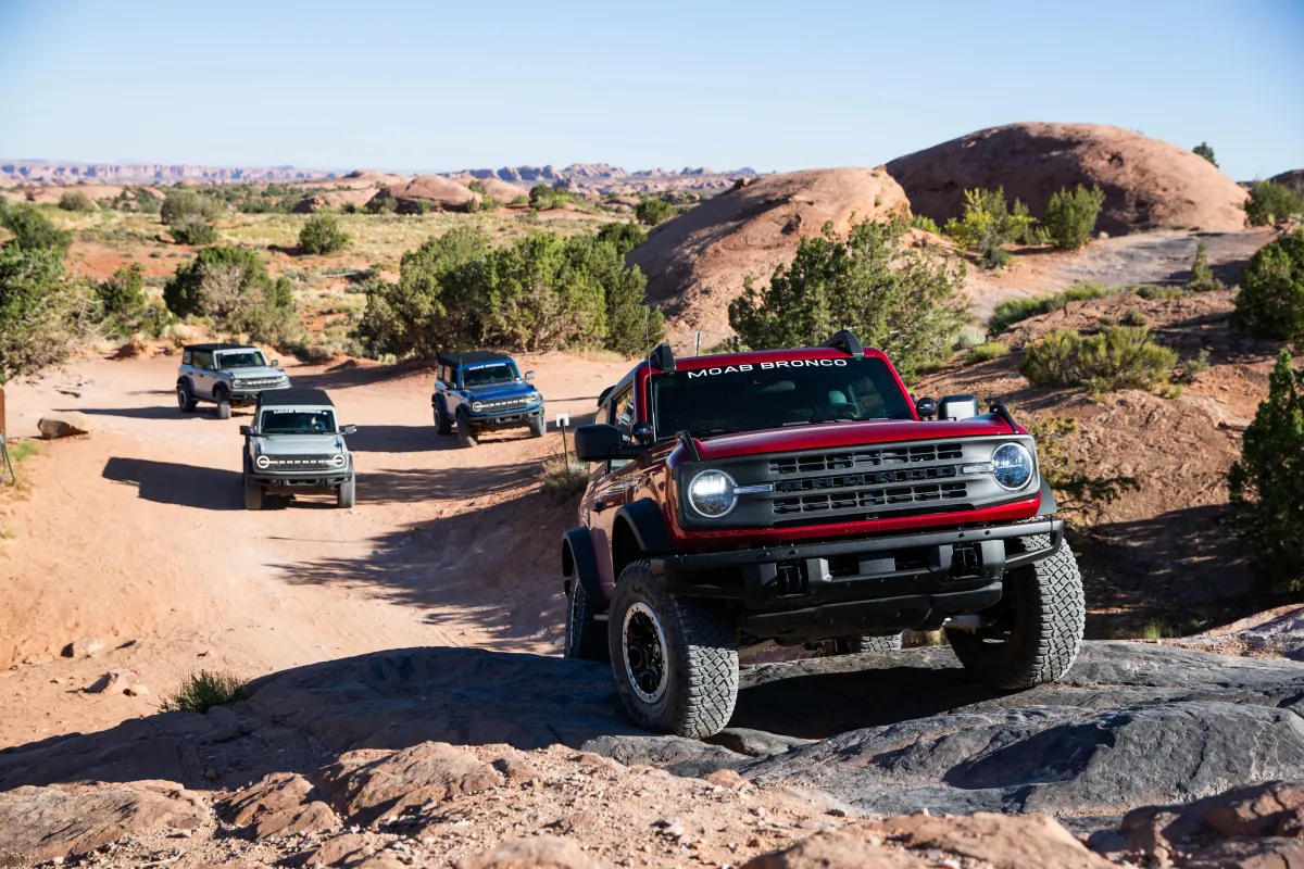
10% OFF ALL 2026 4x4 RENTALS - USE CODE "ARCHES10" TO REDEEM

Recommended Trails

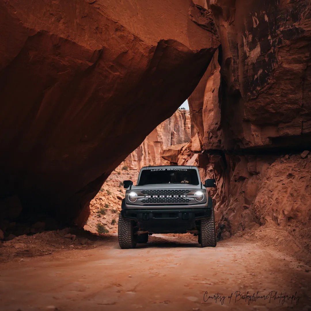
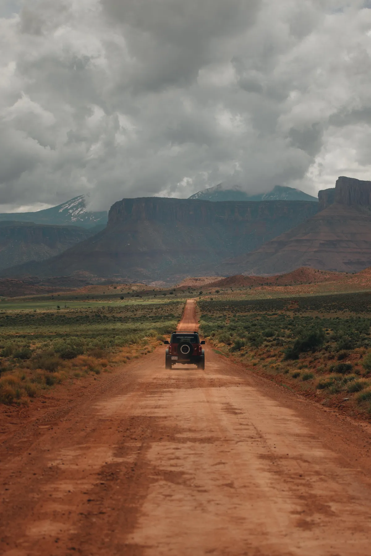
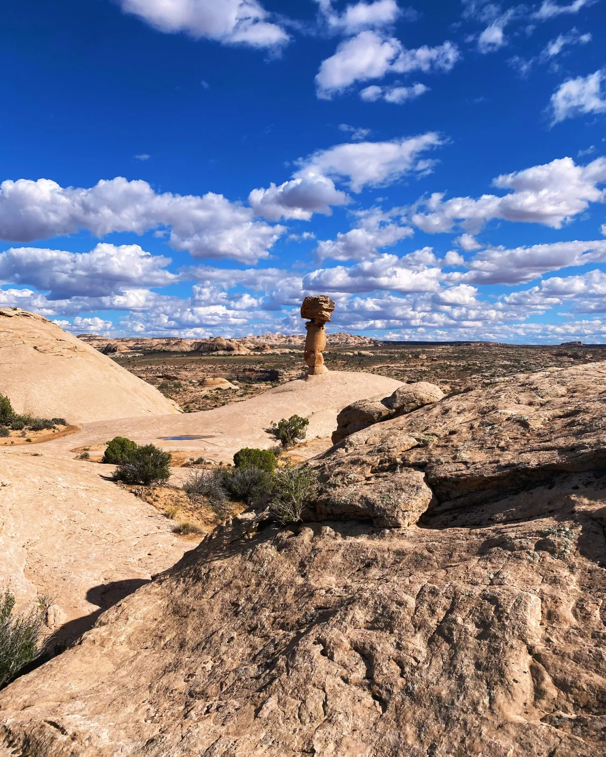
Discover the best that Moab has to offer! These trails are Bronco-approved and perfect for exploring red rock landscapes, thrilling terrain, and unforgettable views—all while staying within safe and permitted routes.
We offer a variety of recommended trails ranging from easy scenic drives to moderate and even challenging off-road adventures—so you can choose the experience that’s right for you.
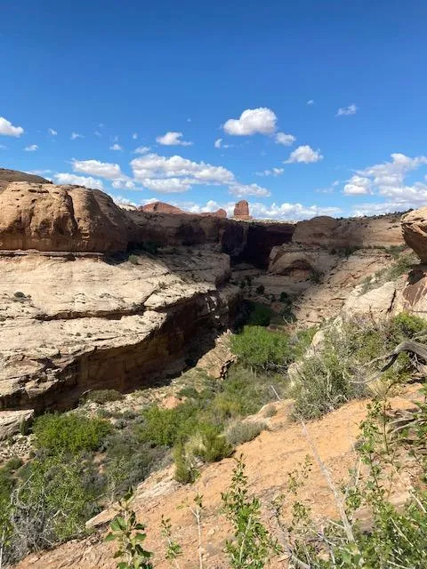
In addition to off-road trails, we highly recommend exploring nearby National Parks, State Parks, and scenic byways. Whether you're cruising through Arches, taking in the vast beauty of Canyonlands, or enjoying a peaceful drive along the Colorado River Scenic Byway (HWY 128), your Bronco adventure starts here.
LONG CANYON PUCKER PASS


Location: Southwest of Moab between highways 313 and 279 . This trail is described downhill, assuming you are starting from Highway 313 (Dead Horse State Park).
Rating: Easy.
Attractions: Amazing scenic views. Petroglyph panels on Potash Rd. (Scenic Byway 279), Jug Handle Arch.
Time & Distance: Trail is 7.5 miles. Allow 1 hour + 30 min travel time to the trail head off highway 313.
Trail Description: From downtown Moab travel North on highway 191 to highway 313 about 11 miles. Travel 14 miles and turn left at Dead Horse Point State Park. In about 1.6 miles turn left again onto the wide gravel road , ignoring all side roads. The road eventually curves left and starts downhill and travels through a short tight switchback, the road narrows as you drop down through Pucker Pass. This section is usually quite easy when dry but can be impassable in heavy rainstorms. You will pass under a giant fallen rock. After this point, the road widens and is easy all the way to highway 279.
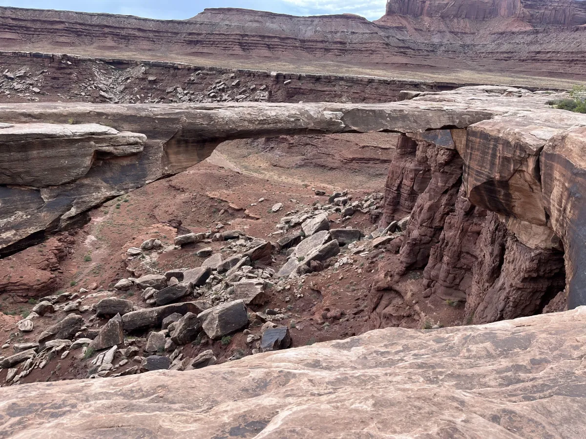
GEMINI BRIDGES
Location: Trailhead is North of downtown Moab on highway 191 about 10 miles. Look for the Gemini Bridges sign on the highway. Turn left into the parking area. This turn is 1.3 miles before highway 313.
Rating: Easy to Moderate. The trail begins on a high, two-lane shelf road.
Attractions: This is one of the most popular trails in Moab. The east side has dramatic views of the La Sal Mountains and Arches National Park. The Gemini Bridges are really two large arches, side by side and several hundred feet high. The bridges are not apparent until you get close. The area is fenced off the last 100 yards so you can park and walk. Very dramatic! Don’t let children play in this area by themselves.
Time & Distance: It is 7.7 miles to Gemini Bridges from the east side (near Highway 191) or 5.6 miles from the west side (starting at Highway 313), a total of 13.3 miles. Allow about 3 hours for the whole trip, plus your return time.
Trail Description: Pass through the parking area, cross a set of railroad tracks and go left. The road will start to make a steep climb. At the high point along this ledge road, don’t be distracted. Pay close attention to traffic which can be heavy at certain times of the year. This road accesses many trails in the area and is extremely popular. Continue south as the road descends and swings a little right through a wide valley. After passing Gooney Bird Rock, other roads head in various directions, but the main road is well traveled. Follow the signs for Gemini Bridges. Bull Canyon Trail will go to the left, this will take you to the bottom of the bridges. You begin crossing slickrock marked with painted dashed lines. The trail then turns into sand. If visiting the bridges. It is required that you park where the fenced area is and walk about 100 yards to the Gemini Bridges. Be very careful exploring on and around the bridges. It is a long way down!
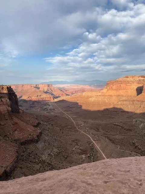
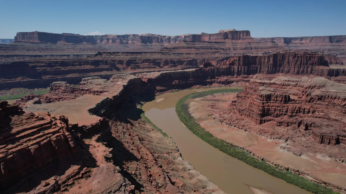
SHAFER TRAIL
Location: Go to Potash road roughly 1.5 miles from the Colorado River just north of downtown. Shafer trail starts when the pavement ends on potash road. This trail will end in Canyonland National Park on highway 313.
Rating: Easy. During winter weather at times the switchbacks can experience closure at the National Park’s discretion.
Attractions: This trail descends 1,500 feet on a section of switchbacks in just over a mile. Wildlife such as Bighorn Sheep can be seen depending on the time of the year. This trail has incredible views of the Colorado River and the La Sal Mountains. Thelma & Louise Point.
Time & Distance: Trail is 18.2 miles. Allow approximately 2.5 hours on the trail and an additional 30 to 45 minutes travel time.
Trail Description: After reaching the end of the pavement on potash road. Jackson Boat ramp has picnic area and great restrooms if needed. The potash mine is still in operation and is fenced in you will follow the dirt road around the mine. You will drive around the evaporation ponds on a well maintained road. The road will continue to Thelma & Louise Point. The road will wind around a narrow shelf road and eventually enter into Canyonlands National Park. You will start the incline around the steep Shafer Switchbacks. This trail ends in Canyonlands National Park on highway 313.
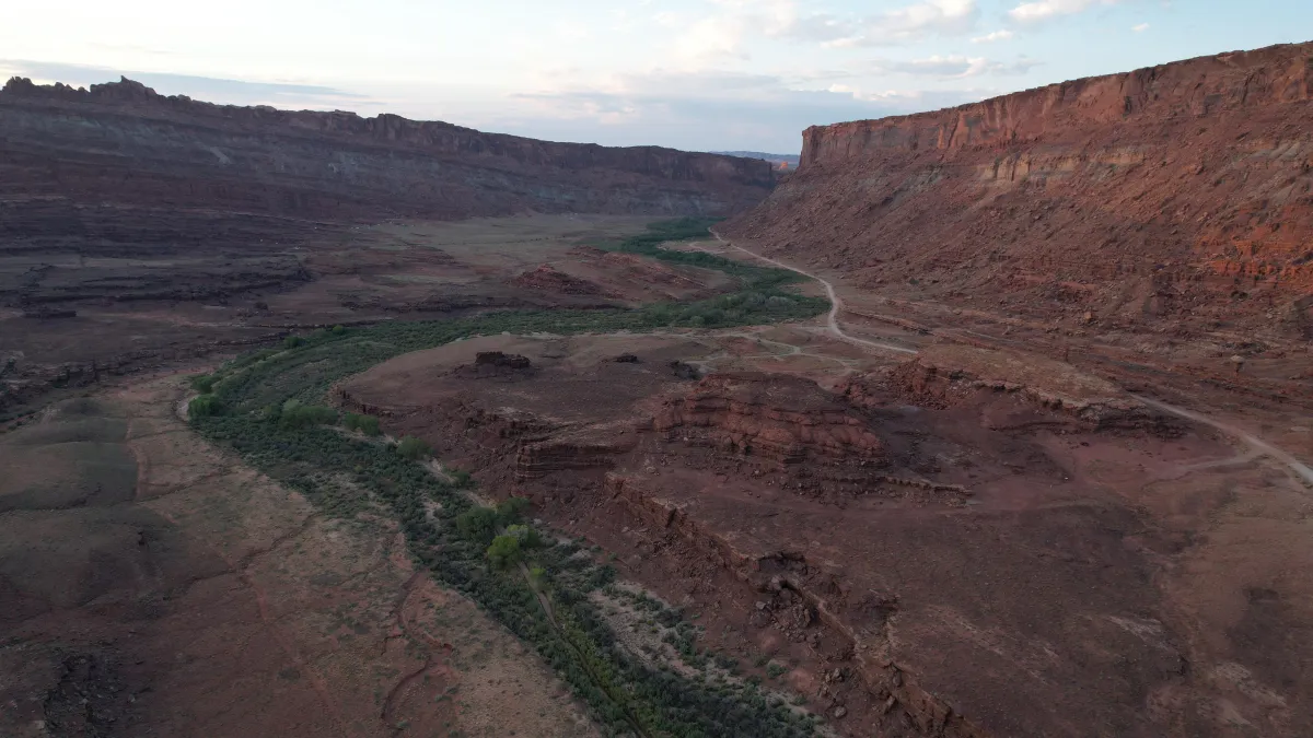
HURRAH PASS
Location: Southwest of Moab, on Kane Creek Road. Stay left on Kane Creek road following the Colorado River. The pavement ends at 4.7 miles and the road will swing left away from the river.
Rating: Easy. A wide gravel road most of the way.
Attractions: This drive has some spectacular scenery. Plan to stop to see ancient petroglyphs on a large boulder next to the road at Birthing Rock.
Time & Distance: Hurrah Pass is 9.7 miles from the end of the pavement. Allow 2 or 3 hours for the round trip.
Trail Description: After the pavement continue on a wide gravel road. About 1 mile look for Indian writings on a large boulder that is Birthing Rock. Keep right after crossing Kane Creek. Kane Creek Canyon Trail goes left. Kane Creek Canyon is on our prohibited list so be sure to swing right. You will begin a gradual climb. The pass is reached at about 10 miles on gravel road. Beyond the pass starts a more difficult descent to Chicken Corners and Lockhart Basin Trails.
ONION CREEK AND FISHER TOWERS
Location: Northeast of Moab off Scenic Byway 128. At the Colorado River Bridge turn right onto highway 128 along the Colorado River. Drive 20.2 miles on highway 128 until you see the sign for Onion Creek. To go to Fisher Towers, stay on highway 128 another 0.8 miles and turn right after the Fisher Towers sign.
Rating: Easy. Onion Creek Road is a well maintained road, but can get washed out along its creek crossings during in climate weather.
Attractions: Onion Creek Road is a relaxing drive through a beautiful deep-cut canyon. The red rock is in the Cutler formation. This area has very distinctive formations. Fisher Towers is a popular tourist destination with spectacular red rock towers. Part of the last Austin Powers movie was filmed in this area, as well as the City Slicker movies and many commercials.
Time & Distance: Onion Creek Road as described here is about 10 miles one way. Fisher Towers is about 2 miles one way. Allow 2 hours round-trip driving time for Onion Creek trail and approximately an additional 30 minutes for Fisher Towers. With stops and hikes you can easily spend a full day in the area. Allow for 30-40 minutes driving time to the trailhead.
Trail Description: Many creek crossings on this trail. This is open range so watch for cattle on the road. Cross a narrow wooden bridge. Prior to having the bridge, the road actually followed the narrow creek under the bridge! Your nose will tell you when you pass by Stinking Spring, a sulphur-based natural spring. You’ll begin to climb out of the canyon on a winding road. Be careful here if the road is wet. This road turns into Fisher Valley Road. Make sure you leave all gates as you find them. Fisher Valley is the end of Onion creek.
CHICKEN CORNERS
Location: Southwest of Moab and off Kane Creek Road. Follow trail description for Hurrah Pass to reach the start of this trail.
Rating: Moderate. Just a few rough spots on this predominantly easy trail. At one point, you’re forced near the edge of a high cliff above the Colorado River. This spot is intimidating, but easy.
Attractions: Descend from Hurrah Pass on the more remote west side to the scenic Colorado River gorge. See Dead Horse State Park and Pyramid Butte across the river. Honeycomb Rock.
Time & Distance: It’s 11.5 from the top of Hurrah Pass to the end of the trail. Allow about 4 hours for the round trip plus an additional hour to reach Hurrah Pass.
Trail Description: At Hurrah Pass start down the west side on a rocky, winding ledge road. Keep left uphill. Jackson Hole Trail goes right. Trail conditions worsen as you drop into a dry wash. A rocky challenge, then keep sharply right uphill. The road flattens out. This is open range so watch for cattle on the road. Keep right following a sign to Lockhart Basin. The road gets rocky again and narrows to a single lane as it winds closer to the river in places. You’ll pass through a barbed wire gate before reaching a key fork. A sign should indicate Lockhart Basin left. Keep right, climbing out of a dry, rocky wash. From here the trail is well defined as it crosses a broad, flat area CHICKEN CORNERS with several easy rocky sections. Gradually a high wall on the left forces you closer to a cliff edge overlooking the river. The narrowest point is the drivable Chicken Corner. It is easy, but may be intimidating to some. The road continues another 1.5 miles where it comes to an abrupt end at a remote overlook. Dead Horse Point Overlook is directly north across the river.
DOME PLATEAU
Location: Follow the Colorado River 30 miles on Scenic Byway 128 just North of downtown Moab. Cross the Dewey Bridge and go left just pass the bridge onto a gravel road. This crosses private property - please be respectful.
Rating: When dry, most of the trail is easy except for a few steep, rocky sections which makes is rated moderate.
Attractions: This trail is relatively easy other than a few difficult sections and the challenging route-finding due to all the old mining roads in the area. It provides one of the greatest scenic overlooks in the area with incredible views of Professor Valley, Castle Valley, and the La Sal Mountains. La Boca Arch is a quick stop and fun little area to explore. Caves Spring is a shallow cave with a small spring at the back. The mining cabins are interesting but be aware they are in disrepair and the mines in the area are poorly secured and very dangerous. Cave-ins are common in old mines and they may harbor deadly gasses. For your safety – stay out of any old mines.
Time & Distance: The trip described here is about 30 miles of dirt road. Note that it’s about 30 miles of paved road away from town, so it’s about 90 miles total and can easily take over 6 hours. Pack plenty of water and a lunch.
Trail Description: As you leave the pavement you will descend into Yellow Jacket Canyon. Use caution on the steep rock ledges here. Continue west and south another 4 miles until a left turn takes you almost due south toward the Colorado River Overlook. This is a great view and a perfect spot to stop for some lunch. Return north along the same road but stay left to access the northern exit route past La Boca Arch and the old mining cabins. After the mining cabins, the road becomes gradually easier until it meets the pavement back to highway 128.
FINS & THINGS
Location: Near downtown Moab in Sand Flats Recreation Area. Once entering Sand Flats area the trailhead starts next to Echo campground.
Rating: Difficult. You’ll encounter some steep rock climbs, loose terrain, and tricky ledges that may be up to 18 inches high.
Attractions: Fins & Things offers an exciting off-road experience with unique landscapes, including “fins” (narrow ridges of rock) and “things” (eroded rock formations). The trail features thrilling climbs, descents, and breathtaking views of the La Sal Mountains. There are several challenges along the way, including optional obstacles for those looking for a more intense adventure.
Time & Distance: The trail is 9.4 miles but total distance is about 20 miles round-trip. Expect to spend about 3 to 4 hours completing the entire trail. This trail is a one way trail but can be broken up into 3 sections. The first section is most popular and should only take about 1.5 hours.
WILLOW SPRINGS
Location: Enter Raptor State Park North of Moab and look for the Willow Springs Signs.
Rating: Easy. It includes a mix of dirt roads, rocky sections, and some sandy washes.
Attractions: One of the main highlights is the fossilized dinosaur tracks. This trail offers a quieter, alternative entrance to Arches National Park.
Time & Distance: Approximately 7.9 miles round-trip. Expect around 1.5 hours to complete the trail, depending on stops and exploration time. If you decide to continue into Arches National Park, be prepared for additional time in the park.
Trail Description: The trail begins with a wide, well-maintained dirt road that gently climbs through the desert terrain. It’s a smooth ride for the first couple of miles, with occasional rocky and sandy stretches. Expect a couple rocky ledges along the way. The trail ends as it connects with the main park road around the Balance Rock area in Arches National Park.
SEVENMILE RIM
Location: The trailhead begins off North Highway 191 approximately 11 miles from town. The route traverses the mesa above Courthouse Rock and parallels Highway 313. Access is typically gained from Cotter Mine Road.
Rating: Difficult. Sevenmile Rim does demand skill and attention. Several sections feature off-camber slickrock, ledges, sand, and steep climbs. The portion near Merrimac Butte, known as "I Lean," can be unnerving due to its side slope exposure. Drivers should have prior off-road experience and a solid understanding of vehicle dynamics in variable terrain. This is not recommended for novice drivers.
Attractions: The trail winds past iconic landmarks including Monitor and Merrimac Buttes, striking twin rock formations named after Civil War-era ironclad ships. A short side trail leads to Uranium Arch, a natural sandstone arch you can walk across. The route also skirts the rim of Sevenmile Canyon, offering wide views across Arches National Park, the La Sal Mountains, and the Book Cliffs. You'll also pass by the towering Determination Towers and the optional challenge obstacle, Wipe Out Hill, known for its steep, v-notched descent and climb.
Time & Distance: The full trail is about 13 miles one way. It typically takes 4 to 5 hours to complete the route, depending on conditions, driving pace, and whether you include side detours like Uranium Arch or Wipe Out Hill. Many drivers spend extra time at scenic stops, so plan for a half-day adventure.
Trail Description: Start at Cotter Mine Road. The trail climbs onto a broad mesa, soon revealing views over Sevenmile Canyon. A marked junction offers a short detour to Uranium Arch, perched near the canyon rim. Back on the main route, the trail meanders westward, hugging cliff edges and winding through slickrock domes. Views of the canyon deepen as you approach the long mesa stretch above Merrimac Butte, where a sloped rock shelf forces the vehicle into a pronounced sideways lean-this is the “I Lean” section, known to test driver nerves.
Beyond Merrimac and Monitor Butte, the terrain transitions into a mixture of sandy stretches and rocky ledges. Keep right at key forks to follow the main trail toward Determination Towers, a cluster of massive sandstone spires. This is where the optional trail to Wipe Out Hill branches off-tackle it- only if you're prepared for a steep, technical descent and climb. Finally, the route drops into Tusher Wash, a sandy canyon that marks the northwestern edge of the trail.
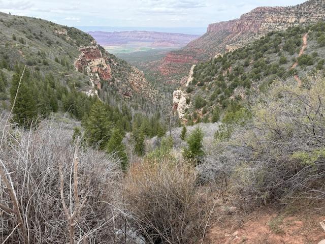
THOMPSON CANYON,POLAR MESA
Location: Polar Mesa begins along Sand Flats Road, just beyond the Porcupine Rim campground. The dirt route climbs through Manti-La Sal National Forest, offering sweeping views of Castle Valley and the La Sal Mountains. It terminates near old mining sites and typically connects with Thompson Canyon and onto Onion Creek.
Rating: Easy to Moderate. Generally a smooth, wide trail with a few rocky ledges.
Attractions: Panoramic Overlooks: Start with a breathtaking rim view over Castle Valley and the La Sals, especially near Porcupine Rim. Mining Ruins: Mid-trail stops include old headframes, pipe remnants, and tailings from early-20th-century uranium operations. Wildflowers & Trilobite Tracks, dinosaur tracks not far. Adjacent Trails: Easily combine with nearby routes like Thompson Canyon and Onion Creek for longer runs.
Time & Distance: Approximately 16–18 miles round-trip from Sand Flats Road to the eastern edge of Polar Mesa and back. (About 27.6 miles round-trip when paired with Thompson Canyon.) Allow 3 to 4 hours for the complete out-and-back route, including stops at overlooks and mining ruins.
Trail Description: Begin on Sand Flats Road, climbing gradually through forested switchbacks. Pause at the overlook near Porcupine Rim for sweeping views. Turn onto Polar Mesa Road. Enjoy steady dirt track with occasional washboard before arriving at mining relics like old headframes-great for history buffs and snapshots.Continue across mesa-top terrains featuring gentle rock ledges and sandy patches. At the eastern plateau edge, intersect Thompson Canyon. From here, many explore Onion Creek nearby and loop back via dirt and paved roads .
BACKWAY TO SECRET SPIRE
Location: This trail begins northwest of Moab, accessed off Highway 313, then turning onto Dubinky Well / Spring Canyon Point Road.
Rating: Moderate. A step above easy desert roads, this trail presents several ledges and steep sandstone ramps.
Attractions: Secret Spire, a mushroom‑shaped Navajo sandstone tower perched atop a domed slickrock platform. Glimpses of the Green River drainage, with distant views of the San Rafael Reef, the Book Cliffs, and rugged canyon rims.
Time & Distance: About 9.3 miles one-way, Expect 3 hours round-trip, factoring in paced driving, photo stops at scenic points, and the short hike to Secret Spire.
Trail Description: Rolling terrain across sand and gravel until you reach the mesa dividing Hell Roaring and Spring canyons. Continue across gentle path-terrain mixes: sandy wash-bottom, scrubland, and occasional slickrock patches. The scenic openness contrasts sharply with canyon-bound sections. The trail dips into upper Spring Canyon, where deep gullies or erosion spots may require cautious navigation.
DELLENBAUGH TUNNEL
Location: Off Highway 313. Go north on Dubinky Well Road for about 5 miles. Near Tombstone Butte, take the short trail to the parking area-this is where the hiking route to Dellenbaugh Tunnel begins.
Rating: Moderate. Although the trail is relatively short and easy, the uneven slickrock terrain and a few steep sections warrant a moderate rating.
Attractions: Dellenbaugh Tunnel, an elongated natural rock tunnel carved into sandstone near the rim above Spring Canyon. A dramatic vantage point overlooking Spring Canyon, offering panoramic views and geological layers.
Time & Distance: Approximately 3.7 miles round-trip for the main hiking route. Plan for about 2 to 3 hours total, including walking down into the tunnel, exploring the canyon view area, and returning by the alternate route if desired.
Trail Description: From the parking lot near Tombstone Butte, follow park signage onto the hiking trail, initially crossing a mix of dirt and lightly eroded slickrock marked with green stripes. The path splits into the lower Main Route, which dips toward the wash, and the View Route, which climbs higher on slickrock domes for broader vistas. The View Route adds about half a mile but fewer steep spots. Both routes reconverge and traverse along Spring.
Contact Info
4903-B Sunny Acres Ln. Moab, Utah 84532
Working hours
Monday: 8:00am - 6:00pm
Tuesday: 8:00am - 6:00pm
Wednesday: 8:00am - 6:00pm
Thursday: 8:00am - 6:00pm
Friday: 8:00am - 6:00pm
Sat-Sun: 8:00am - 6:00pm
@ 2025 Copyright. All rights reserved.